


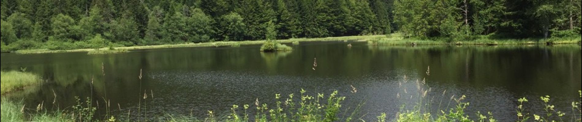
lac de Lispach

fedinois1
User
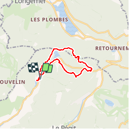

Length
10.4 km

Max alt
1091 m

Uphill gradient
275 m
Km-Effort
14.1 km

Min alt
858 m

Downhill gradient
278 m
Boucle
Yes
Creation date :
2015-07-06 00:00:00.0
Updated on :
2015-07-06 00:00:00.0
4h06
Difficulty : Easy

FREE GPS app for hiking
 SityTrail
IGN / Geographical institutes
SityTrail Plus
The world is yours!
About
Trail Walking of 10.4 km to be discovered at Grand Est, Vosges, La Bresse. This trail is proposed by fedinois1.
Description
Randonnée facile avec quelques raidillons.
Photos


Positioning
Country:
France
Region :
Grand Est
Department/Province :
Vosges
Municipality :
La Bresse
Location:
Unknown
Start:(Dec)
Start:(UTM)
345999 ; 5323169 (32U) N.
Comments
Rien à dire, conforme aux attentes.M'a permis de sortir de pas mal de situations désagréable en randonnées.